Geovisualisation
In this Geovisualisation section, I use GIS software as a design tool and open-source datasets to create compelling visualisations of both geographical and non-geographical data.


A map using the Spilhaus projection to depict the journey, adventures and timeline of the Nautilus, as imagined in Jules Verne’s iconic novel.
Twenty thousands leagues under the sea
Ancient Campania, Italy
This vintage-style map represents the terrain of Italy’s Campania region, featuring iconic sites including Mount Vesuvius, Pompeii, and Herculaneum. A 3D view is created through contour lines rendered with a mismatched, wave effect.


Black Shadows :
Organised crime in Southest Asia
A thematic map illustrating the severity of organised crime and mafia-related activities across Southeast Asia, based on data from the Global Organized Crime Index.

Fantasy map of France :
Mystery and Legend
A fantasy map of France in the style of The Lord of the Rings, where real landscapes like mountains, rivers and cities blend with legends and mysteries, transforming France into Middle Earth.
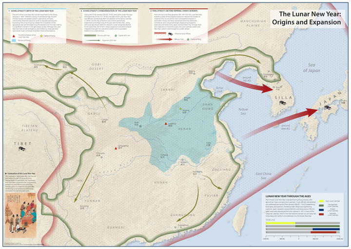
A thematic map inspired by "History of the world in maps", it displays the origin, evolution and expansion of the lunar new year.
Origin and Expansion of Lunar New Year